
Vacant & Commercial Land Drone Photography in El Paso
As an FAA-certified El Paso land photographer, we specialize in vacant land drone photography and commercial land drone photography. Our team captures high-resolution aerial land photography for parcels, acreage, and commercial properties across El Paso, Horizon City, Santa Teresa, and Hudspeth County.
“Show investors more than dirt — highlight scale, access, and potential.”
Why Drone Photography Matters for Vacant & Commercial Land
Professional drone photography goes far beyond a few overhead shots. Our aerial services give buyers and investors the information they need before stepping foot on your property.
Our Land Photography Services in El Paso
We specialize in vacant land, commercial properties, and acreage captures tailored to investors, developers, and site planners.
Vacant Land Drone Photography
High-resolution aerial photos that highlight lot layout, boundaries, and terrain.
Commercial Property & Acreage Photography
From 10 acres to 100+, we capture large tracts with clarity, ensuring every angle is covered for buyers and brokers.
Parcel Drone Photography & Aerial Overviews
Perfect for subdivided lots or land near growth corridors like Horizon City and Santa Teresa.
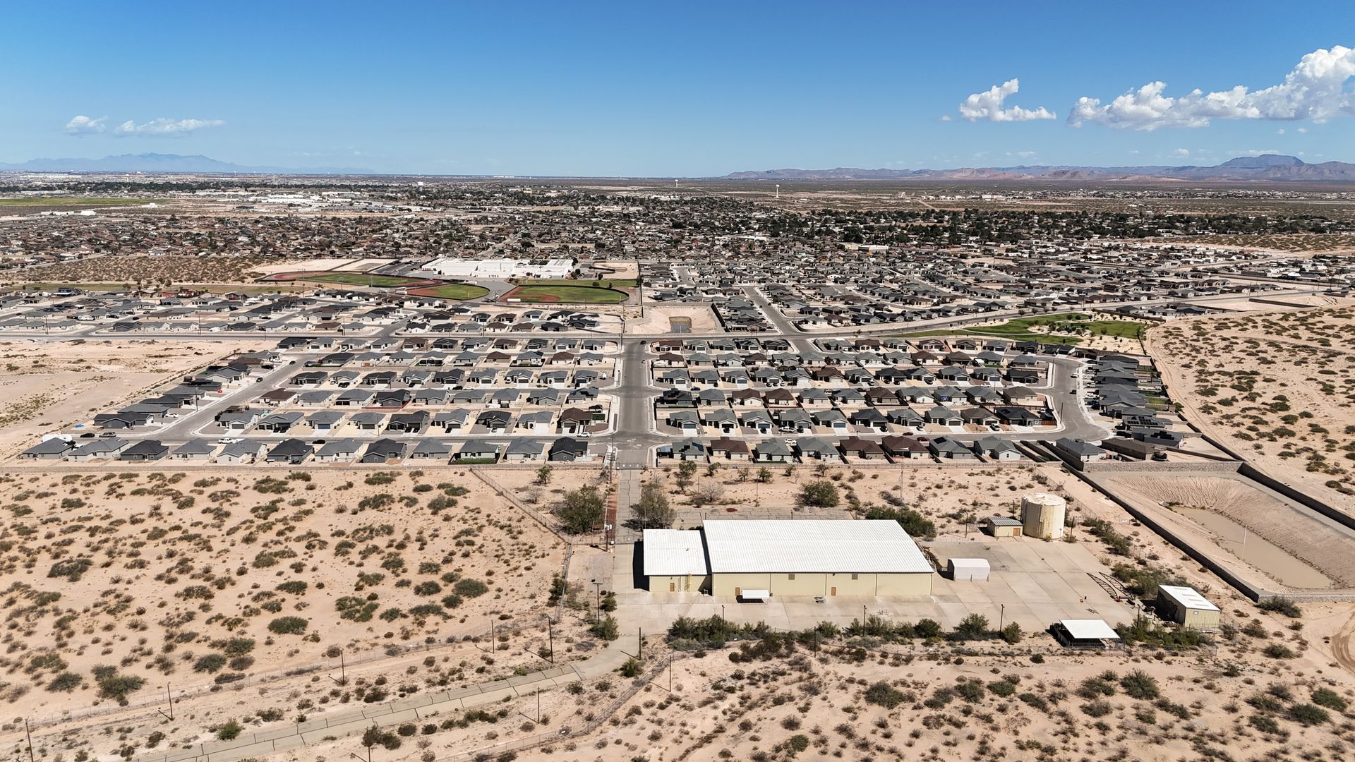
Case Study: Horizon City Acreage – 360° + From Above Interactive Map
This Horizon City land project at 1 LTV Dr showcases how From Above Droneworks delivers more than photos. By combining drone aerial photography, 360° panoramas, and parcel boundary overlays into one Interactive Property Map, brokers and investors gained a clear view of access points, lot boundaries, and development potential. As one of the first providers in El Paso to offer integrated parcel mapping with drone visuals, this case demonstrates the future of land marketing in West Texas.
How to Use This Interactive Map
Every From Above Maps project includes an interactive map designed for you to explore. These maps bring together drone aerials, 360° views, and parcel layers so stakeholders and community partners can see progress in real time.
Try it for yourself:
- Click parcels and pins to unlock project details
- Switch base layers to change how the site is viewed
- Explore 360° photos and aerial captures from key points
- Zoom and pan to take control of your perspective
This is your chance to see the project the way decision-makers do — from above, interactive, and always up to date.
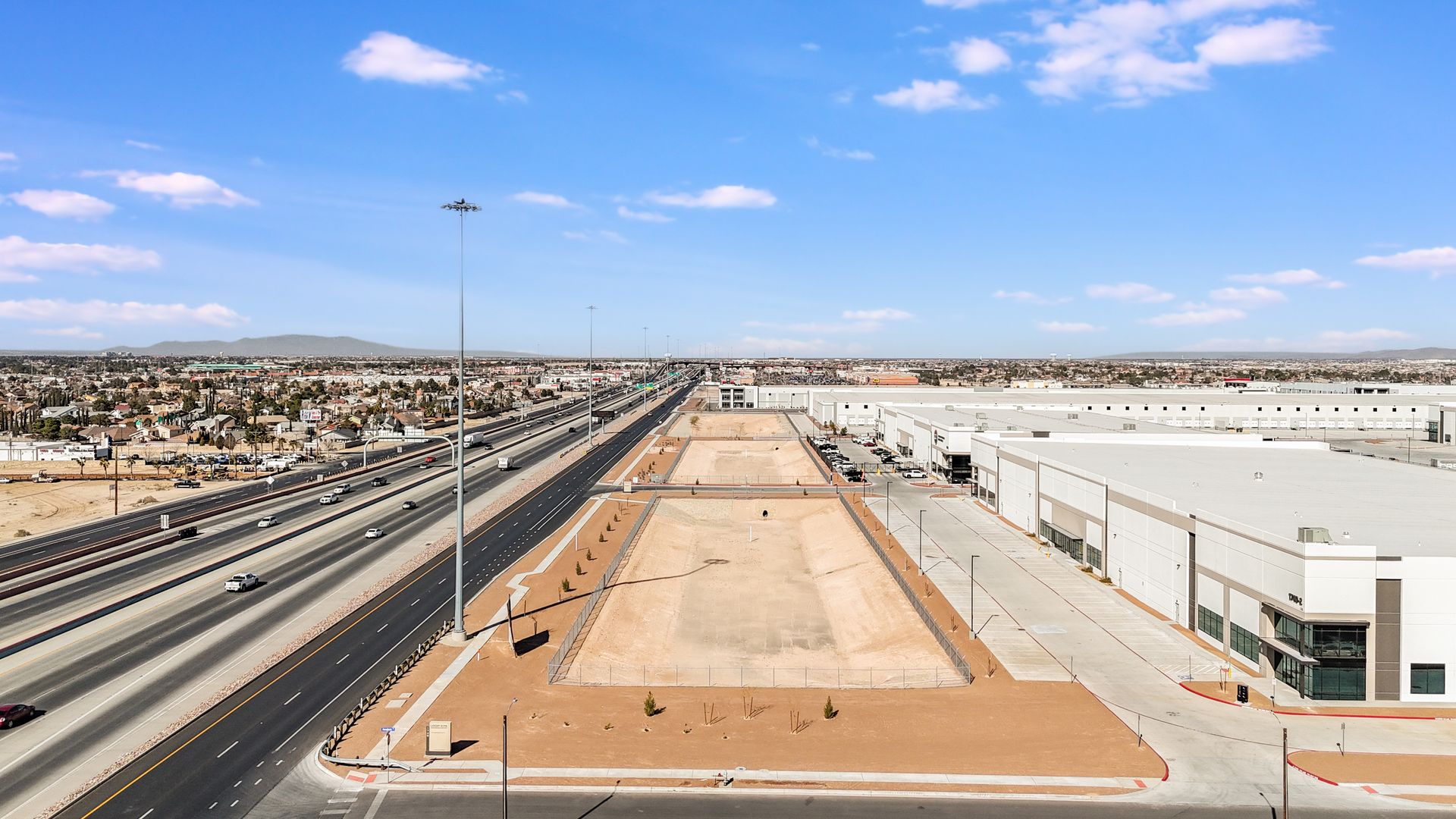
Case Study: MCA Land Development Interactive Map | Medical Center of the Americas El Paso
The Medical Center of the Americas (MCA) is leading a 440-acre transformation in El Paso, creating a world-class biomedical district. From Above Maps partnered with MCA to develop an interactive campus map featuring drone aerials, 360° views, and parcel-based development layers. This living map gives stakeholders, city partners, and investors a clear view of progress and future phases — helping MCA showcase its leadership role in shaping El Paso’s innovation district.
MCA Land Development Interactive Map in El Paso — updated with drone aerials, 360° views, and parcel layers to track the growth of the biomedical campus.
From Above Maps – Boundaries That Tell the Full Story
Flat aerials show the land. Interactive maps show the opportunity. With our premium service, we combine professional drone photography, 360° tours, and Land id® parcel overlays into one shareable map. Buyers and investors get instant clarity on boundaries, access points, and development potential — all from a single link.
From Above Maps™ transforms property into clarity. By combining drone aerial photography, 360° views, and parcel boundary overlays into one interactive map, we give developers, brokers, and investors a complete picture of their property. Each map is branded, shareable, and built to highlight access points, lot boundaries, and surrounding infrastructure. From Above Maps™ helps you market smarter, present with confidence, and make faster decisions in the El Paso region and beyond.
Map Your Property
Turn raw land into a clear, interactive map with aerial drone imagery, 360° views, and accurate parcel boundaries. Perfect for acreage, development sites, and commercial projects.
Professional Map Making for Real Estate & Business
From brokers to developers, give your team and clients professional-grade maps that combine property data with immersive visuals — built for sales, planning, and investor presentations.
Share With Anyone
One link. Any device. Instantly share your branded map with clients, partners, or investors so they can explore the property like Google Maps — but customized for your land.
“Packages built to match your land and property needs.”
Land Drone Photography Packages & Investment Options in El Paso
Up to 10 Acres – Quick Capture Package
- 20+ high-resolution aerial photos
- 30–45 second video flyover reel
- MLS & unbranded delivery options
Best For: Small parcels, residential lots, and quick MLS listings.
40+ Acres – Full Development Package
- 50+ aerial photos with 360° panoramas
- 2-minute site overview video
- Logistics highlights: interstate access, rail proximity, industrial hubs
Best For: Large tracts, development sites, and acreage marketing.
10–40 Acres – Investor Ready Package
- 30–40 aerial photos with optional boundary overlays
- 60–90 second investor reel
- Access points and utility highlights
Best For: Mid-size parcels, commercial brokers, and investor presentations.
360° Land Tour Package
- 15+ high-resolution aerial photos
- 360° interactive panorama (Kuula-compatible and MLS-ready)
- Boundary and feature callouts (roads, utilities, access points)
- Unbranded + branded versions for listings and investor decks
- Standard 48-hour delivery
Best For: Landowners and brokers who want buyers to explore the property interactively on desktop or mobile.
Book Your Vacant Land Drone Photography Today
Ready to showcase your property with professional aerials? Our FAA-certified team delivers investor-ready photos, video, and 360° tours across El Paso, Horizon City, Santa Teresa, and Hudspeth County. Fast turnaround, clear pricing, and compliance you can trust.
📞 Call us at 915-213-3430 or click the form to get started.
Request A Free Quote!
FAQs – Land Drone Photography in El Paso
Here are answers to the most common questions about our vacant and commercial land drone photography services in El Paso.
How much does vacant land drone photography cost in El Paso?
Our packages start with flat rates based on acreage, beginning with small parcels and scaling up for large tracts. Custom quotes available.
Do you provide MLS-ready photos and videos?
Yes. We deliver both branded and MLS-compliant versions of all media.
Can you cover acreage outside El Paso, like Horizon or Hudspeth County?
Absolutely. We regularly capture land across Horizon City, Santa Teresa, and Hudspeth County.
How fast will I get my land photos and video?
Our standard delivery window is 24–48 hours after your shoot.
Can drone photos help sell vacant land faster in El Paso?
Yes. Listings with professional drone photography consistently attract more buyer attention and generate higher engagement online. For vacant and commercial land in El Paso, aerial photos highlight property scale, access points, and nearby infrastructure — giving investors the details they need to act quickly.