REGULATIONS &
RESOURCES
Interactive Restricted Airspace Map for El Paso – Check Your Location
Find out if your location in El Paso is in restricted airspace with our interactive map. This tool shows FAA-designated no-fly zones, including areas around El Paso International Airport, Fort Bliss, and other sensitive locations.
- Enter your address below to see if you’re in a restricted area.
- If your location is restricted, a waiver can be processed to request an exception for drone operations.
Stay compliant with FAA rules, fly safely, and navigate El Paso’s airspace with confidence.
Your Guide to Drone Regulations and Resources in El Paso
Introduction
Welcome to your essential resource for understanding drone regulations in El Paso. Whether you're a hobbyist or a professional, navigating drone use laws is crucial for safe and legal flying.
Local Drone Laws
Overview of El Paso Drone Regulations
El Paso adheres to both federal and state drone regulations, but there are local ordinances specific to the city that you must follow. These rules are designed to protect privacy, ensure public safety, and prevent disturbances in sensitive areas.
Drone Registration Process
Steps to Register a Drone in El Paso
- Identify Your Drone Type: Whether it's for recreational or commercial use.
- FAA Registration: Complete the FAA registration and mark your drone with the registration number.
- Local Compliance: Check if there are additional local registrations required in El Paso.
Specific Local Restrictions
Note that drones are prohibited in certain parks and near government buildings in El Paso. Always check the latest local ordinances before your flight.
Federal and State Drone Laws
While flying in El Paso, drone operators are subject to FAA regulations and Texas state laws. This includes registering your drone with the FAA and adhering to the FAA’s Part 107 guidelines if you’re flying for commercial purposes.
Safety Tips
To ensure safe operations, always maintain a line of sight with your drone, avoid crowded areas, and never operate your drone under the influence of alcohol or drugs.
Flying Zones and Restrictions
Compliance with drone flying zones in El Paso is crucial for safe and legal operations. Our interactive map details restricted areas, such as near airports and military bases, to prevent airspace conflicts and enhance safety. Please keep an eye on our regularly updated map, which includes temporary flight restrictions (TFRs) and controlled airspace details. Adhering to these guidelines is vital to avoid penalties and ensure the safety of all airspace participants.
Essential Resources for Drone Operators
Regulatory and Safety Information
Stay informed about the latest in drone regulations and safety practices
AutoPylot: Flight Planning Made Easy
All-in-One Flight Planning for Drone Pilots!"
AutoPylot has everything a drone pilot needs in one place! With smarter planning tools, it connects my missions to the most important information, like airspace, weather, and flight management. As an FAA-approved provider of B4UFLY and LAANC services, AutoPylot makes flight preparation faster, safer, and stress-free. Highly recommended for anyone in need of reliable drone planning solutions!
Real-Time Flight Tracking with Flightradar24
Flightradar24 is a powerful live flight tracker that provides real-time air traffic data worldwide. With its extensive coverage and user-friendly features, it’s an invaluable tool for drone pilots to monitor manned aircraft activity, enhance situational awareness, and ensure safe operations. Features include detailed flight paths, aircraft information, and altitude data, making it a must-have resource for professional and recreational drone operators alike.
Dronecast: Reliable Weather Reports for Drone Pilots
"Accurate Weather for Drone Pilots"
Dronecast offers simple, detailed weather reports and forecasts made just for drone pilots. Quickly check flying conditions to plan safer and better flights. Great for both hobbyists and professionals!
Air Aware: Advanced Airspace Tools for Drone Pilots
"Advanced Airspace Transparency for Drone Pilots"
Developed by the creators of B4UFly and Pilot Institute, Air Aware is the next-generation app for drone pilots. It provides unmatched airspace clarity and includes the world's largest database of terrestrial drone operation rules, making it easier to fly safely and confidently.
UASidekick: Drone Tools for Public Safety
"UASidekick: Streamline Drone Operations for Public Safety"
UASidekick is designed to improve drone programs for law enforcement, fire departments, and search-and-rescue teams. It simplifies the flight process and helps pilots comply with FAA guidelines by easily filing NOTAMs and accessing essential operational tools.
DroneDeploy: High-Accuracy Mapping Made Easy
"DroneDeploy: All-in-One Drone Mapping Software"
DroneDeploy offers high-accuracy drone software for reality capture, site mapping, and ground-to-aerial solutions. Its user-friendly platform simplifies drone operations, making it a top choice for professionals across industries.
FAA UAS Data Delivery System
Use the FAA UAS Data Delivery System for the latest on where drones can and cannot fly. This tool is essential for anyone flying drones, providing current details on no-fly zones and flight restrictions. It’s a must-have for safely planning your drone flights according to federal rules.
National Aeronautics and Space Administration (NASA) UTM (UAS Traffic Management) Project:
Explore NASA’s UTM Project, designed to safely integrate drones into national airspace. This initiative focuses on advanced technologies to manage drone traffic efficiently, crucial for ensuring seamless coordination with manned aircraft. Ideal for those interested in the future of drone operations, the UTM Project offers insights into developing trends and safety protocols for aerial systems.
DJI FlySafe
Explore DJI FlySafe, a comprehensive program designed to help drone pilots navigate and adhere to local regulations. This program includes the DJI Geo Map, an interactive tool that shows where you can and cannot fly your DJI drone. It provides real-time data on no-fly zones, airport areas, and other critical airspace restrictions. Ideal for both new and experienced pilots, DJI FlySafe is an essential resource for planning safe and legal drone flights.
SkyWatch Aviation Insurance
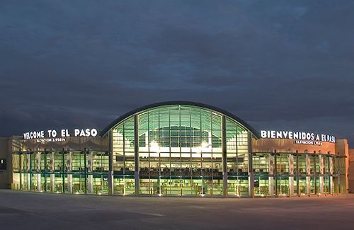
Drone Flying Near El Paso Airport
To safely operate drones near El Paso Airport, it's crucial to follow specific FAA regulations. Drones must not enter restricted airspace around the airport without prior authorization, typically required within a five-mile radius. This precaution helps prevent interference with ongoing air traffic. Drone operators are encouraged to utilize the FAA's UAS Data Delivery System for up-to-date airspace restrictions and to obtain necessary flight approvals. This resource ensures pilots are fully informed and compliant with all flying regulations in the area.